Aquatech Co.,Ltd.
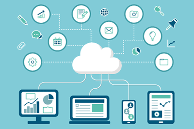
Infrastructure Management DX
Infrastructure Management DX Solutions
GIS(Geographic Information System) is a technology that associates geographic location with relevant information and visually displays it on a map.
We provide and propose technical services that streamline the management of social infrastructure information, which until now has been mainly stored on paper, by linking it with geographic information . The services provided by our company are as follows.
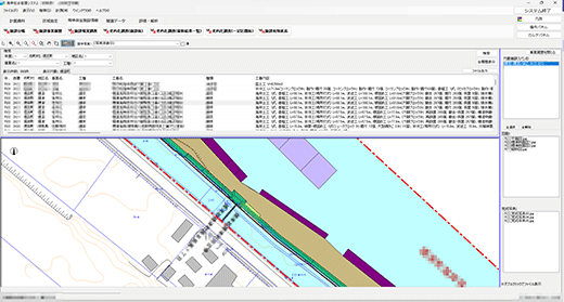
Fishing port management systems
Much of the information related to fishing port facilities is stored on paper, making management and retrieval complicated and labor-intensive.
By digitizing this information and linking it to GIS, we provide a system that centrally manages data related to fishing port facilities and supports the development and maintenance of these facilities.
Systems provided
Cloud – type fishing port electronic ledger
- Daily management made easy. No dedicated PC is required, so it can be accessed not only from the office but also from the field!
- You can rest assured that your data will not be lost even in the event of a natural disaster!
Quick response and disaster recovery assistance when a disaster occurs

Stand – alone fishing port electronic ledger
- A System using GIS system software SIS* created by Informatix Inc.
- Create and customize ledgers and other information to meet the needs of fishing port managers.Optimize custom inspection items, etc.
*We also sell SIS GIS system software products created by Informatix Inc. Please refer to Informatix’s product informationfor product features and other information.


Various functions
- Ortho image display
- View construction data information, completed photos and drawings
- Fishing port electronic ledgers
- Geological survey results
- Results of aging surveys
- Consignment work reports
- Fishing port electronic floor plans
- Photo display of each facility
- Standard cross-sectional view display for each cross-section
In addition to registering existing data, the system also reduces management labor by correlating various types of information with each other.
Coastal management system
Coastal protection facilities protect lives from coastal erosion, high waves, tsunamis, etc., so infrastructure maintenance of these structures is important for the safety of the population. Our company provides a system that allows central management of these facilities.
Various functions
- Business data
- Various survey data
- Aerial photos/Satellite images
We support decision-making and business planning in a wide range of fields, including asset management of coastal protection facilities and comprehensive sediment management.
Daily inspection registration system


Many structures are constantly exposed to rain, wind, snow, and high waves. As a result, parts of a facility may be damaged and the functionality of the structure may be lost, putting lives at risk . Therefore, it is important to regularly inspect these structures to ensure that they are sound.
We provide a system that allows administrators to easily register the inspection results they perform on a daily basis.
Seagrass bed management system
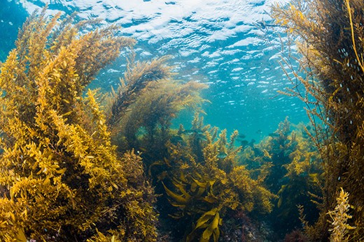
Seagrass beds are ecosystems that absorb and store CO2 from the atmosphere, thereby reducing greenhouse gas emissions and helping to combat climate change. In addition, seagrass beds maintain the stability of marine ecosystems, contribute to fisheries and water purification, protect coastlines, and maintain coordination of the entire ecosystem. Therefore, preserving seagrass beds is extremely important in achieving carbon neutrality and sustaining life.
Methods such as aerial photography and satellite image analysis have been established, and in the future we will be able to determine the distribution of seaweed beds in near real-time and understand seasonal changes in seagrass bed coverage. By centrally managing this real-time data in conjunction with aerial photographs and satellite images, we can create an effective database.
Road management system
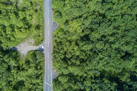
Roads are indispensable structures for daily life, not only for transporting and moving goods, but also for housing lifelines. Therefore, their management is important to ensure safe use.
By creating a database of road information, maintenance management can be carried out more efficiently. Our company provides support for creating road data to be registered in a database.
River management system
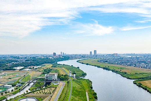
Japan’s rivers are short and steep, so when it rains, the water swells and rushes into the ocean, reaching its flood peak within a short period of time. Additionally, most of Japan’s urban areas are located below river water levels, making them susceptible to flooding.
Flood control is important to protect lives from floods. Our company uses GIS to help analyze the information necessary to calculate areas that require maintenance and areas prone to inundation.